


|
Matthews
Point Marina & Yacht
Sales
|
|||
|
||
|
||
|
Nautical Chart
|
|||
 |
||||||
|
Marina Approach
& Docking
|
||||||
|
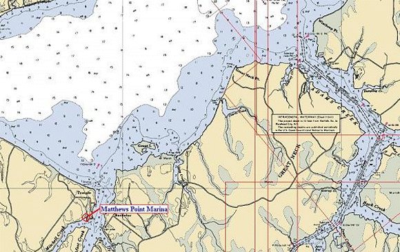
Approximately
4 miles west of the marker for Adams Creek and the Intracoastal
Waterway is Green day mark #1 indicating the entrance to historic
Clubfoot Creek. Turn to the south and follow the channel markers to the
privately maintained buoys for the Matthews Point Marina channel. We
have limited transient space, so please call ahead (252-444-1805). The
fuel dock is on the west side of the western most dock.
Please
call the Dockmaster on VHF Channel 16 for directions. 34.90735N (34:54.50N) 76.89490W (76:45.75W) (NOAA Chart 11552) |
||||||